As the most sensitive and long series indicator and proxy of climate change, glacier change information has been regarded as the most important data resource in global change study. China is the largest middle latitude country with the largest glacier area, and has the largest glacier area around the world besides Antarctic and Greenland. The investigations of glacier distribution and their changes are thus very important, to the evaluation of water resource and building of national defense infrastructure in western China, to the developments of Chinese cryospheric research, and also to the world’s global and planetary change study.
“The Datasets of Second Glacier Inventory of China” were formally released at Beijing on December 13, 2014. The release meeting was chaired by Professor Ningliang Wang, the deputy director of Cold and Arid Region Environmental and Engineering Research Institute (CAREERI), Chinese Academy of Sciences (CAS). CAS Member Dahe Qin, and Professor Shihua Lü, the secretary of Communist Party and deputy director of CAREERI, CAS, were invited to attend this meeting and remarked on the data release. Officers from related departments of Ministry of Science and Technology of China (MOST) and CAS, and tens of invited experts in related scientific fields, were also attended in the data release meeting. The reporters and journalists from People’s Daily, Guangming Daily, China Central Television (CCTV), China Daily, and other 12 news media participated the data release meeting, and published news shortly after the meeting.
The First Glacier Inventory of China (FGI-China) was compiled based on topographical maps and aerial photographs acquired during 1950s to 1980s, under the leadership of CAS Member Yafeng Shi (1919-2011), and was completed in 2002. It gives a total number of 46377 glaciers with a total area of 59425 km2. The significant warming of global climate also bring larger impacts on glaciers in western China, therefore the outdated FGI-China cannot fulfill the urgent demands on the updated information of glacier distribution in different social and economic fields.
The Second Glacier Inventory of China (SGI-China) was a totally new investigation on the updated distribution of Chinese glaciers under the support of a MOST project entitled “the investigation of glaciers and their changes in western China”. This glacier inventory was compiled based on Landsat TM and ETM+ images acquired between 2006 and 2010, by using the widely applied methods to delineate glacier outlines and calculate the glacier parameters. At the end of 2013, the glacier inventory of 86% glacierized area in western China was compiled. The remaining areas are mainly locate at southeastern Tibetan Plateau, where no good quality Landsat images without snow and cloud cover can be found due to the intensive influences of south Asia monsoon in this region. In current released datasets, glaciers in this region were substituted by the digitized version of FGI-China after systematic revise, and totally 6201 FGI-China glaciers with a total area of 8753km2 was used. According to the current released Chinese glacier inventory, there are 48571 glaciers with a total area of 51840km2 in western China, and the estimated water storage amount to 4494km3. About 90% of the glacier area of SGI-China distributes in Xinjiang and Xizang provinces, while 30% and 34% distributes in the drainage basins of Yarlung Zangbo River and Tarim River.
By comparing the finished parts of new SGI-China and the digitized FGI-China, CAREERI scientists gave a draft illustration of the glacier change in western China. Totally about 18% glacier area has vanished during last 30-50 years. The biggest glacier area shrinkage occurred at Mountain Altai and Gangdise, with change ratio of -37.2% and -32.7%, respectively. The Mountain Karakorum, Altun, Kunlun, and Qiangtang Plateau, have the lowest change ratio (-11.3% to -8.4%). Glacier change in other mountain ranges have moderate level (-27.2% to -21%). The distribution of annual glacier change also shows similar spatial patterns. Qiangtang Plateau shows the smallest glacier change (about -0.2%/a), while the regions in Mountain Gangdise and adjacent north slope of Himalaya Mountain, and the source region of Indus River around western Himalaya, show the largest glacier shrinkage (about 2.2%/a). The moderate glacier change mainly distributed around regions in Mountain Tianshan, Qilian, and northern Tibetan Plateau.
Currently the SGI-China dataset has been uploaded onto the Cold and Arid Region Science Data Center at Lanzhou (website http://westdc.westgis.ac.cn/data/f92a4346-a33f-497d-9470-2b357ccb4246), and provided data services for the national defense infrastructure building of western China, for the land investigation of Gansu Province, and for several larger national scientific research projects. The SGI-China dataset has very larger potential of wide usages, with the quick developments of social economy of western China and the growing demands to updated glacier inventory data from many research projects.
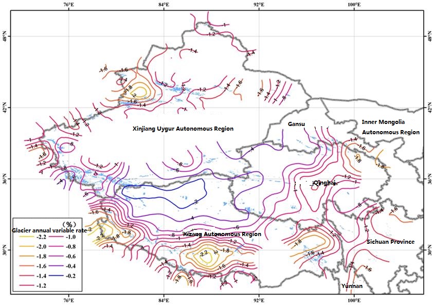
Fig. 1. Location of the studied site
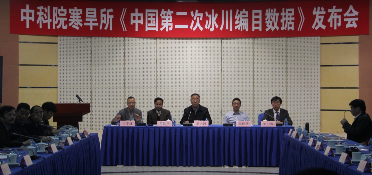
Fig 2. The release meeting